3D Laser Scanning: How ENGINYRING Delivers Surveyor-Neutral CAD Precision
In today’s fast-evolving world of architecture, engineering, and construction, 3D laser scanning has redefined the standard for accuracy, efficiency, and comprehensive documentation. But while scanning hardware captures billions of data points, the real value lies in transforming those raw 3D laser scans into actionable deliverables—whether as precise 2D drawings or advanced 3D models. At the heart of this transformation stands ENGINYRING, the surveyor-neutral provider trusted for impartial, high-quality CAD conversion and digitalization services.
What Is 3D Laser Scanning?
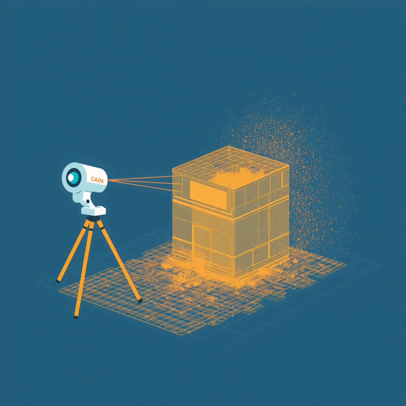
3D laser scanning is a non-contact measurement technology that uses laser light to rapidly capture the exact size and shape of objects and environments. The result is a dense “point-cloud” dataset, representing every surface detail with millimetric precision.
- Speed and completeness: Scans entire buildings, sites, or mechanical components in minutes to hours
- Non-destructive: No need to touch or disturb the physical site
- Versatile: Used for as-built documentation, renovations, heritage preservation, industrial design, and more
However, a point-cloud alone is not a deliverable. It requires expert processing to become a usable 2D drawing or 3D model for engineers, architects, facility managers, or manufacturers.
ENGINYRING: Surveyor-Neutral, Client-Focused
One of the biggest concerns in the world of laser scanning is neutrality. Many processing firms are directly affiliated with survey companies or equipment brands, leading to concerns about bias, data lock-in, or conflicts of interest. ENGINYRING was founded with a clear mission: to provide independent, surveyor-neutral processing of laser scan data for clients worldwide.
- No hidden agendas: We process data impartially, regardless of who performed the scan or which hardware was used
- Universal compatibility: Accepting a wide range of point-cloud formats for seamless collaboration
- Transparent, client-first workflow: Every project is handled with confidentiality, technical rigor, and open communication
This neutrality empowers you to choose the best field surveyor for your needs—while always relying on ENGINYRING’s expertise for the digital conversion and modeling stages.
Surveyor registration quality determines baseline accuracy. Understanding point cloud registration processes helps you evaluate the data foundation before ENGINYRING begins processing.
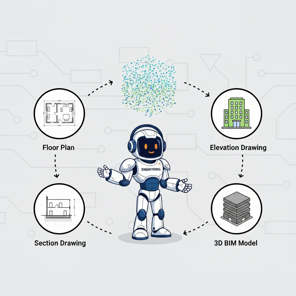
From 3D Laser Scans to 2D Drawings: The Digitalization Journey
Transforming a raw point-cloud into a usable 2D drawing is a process that demands technical precision and deep domain knowledge. Here’s how ENGINYRING manages every step:
- Data Intake & Validation
- Receive point-cloud files in standard formats from your surveyor or scanning team
- Assess scan completeness, quality, and alignment
- Flag any gaps or misalignments before modeling begins
- Point-Cloud Cleaning & Preparation
- Remove noise, redundant points, and irrelevant data
- Register multiple scan stations into a unified coordinate system
- Isolate areas of interest according to your project scope
- 2D CAD Extraction
- Manually trace and digitize key features: walls, openings, columns, fixtures, infrastructure lines, and more
- Apply technical drafting standards for clarity and consistency
- Produce accurate floor plans, elevations, sections, or site layouts
- Quality Assurance
- Overlay 2D extractions on original point-clouds for cross-verification
- Check all dimensions, alignments, and annotation for compliance
- Peer review by a senior drafter or project manager
- Final Delivery & Support
- Deliver industry-standard CAD files (DWG, DXF, PDF) ready for immediate use
- Provide guidance for integration with your own workflows and systems
- Available for revisions, feedback, and technical support post-delivery
Explore ENGINYRING’s specialized 2D drawing and drafting services for detailed information on our approach and deliverables.
From Point-Cloud to 3D Model: Building the Digital Twin
For more advanced applications, 3D laser scans are transformed into precise, data-rich 3D models—often serving as the foundation for BIM (Building Information Modeling), digital twins, or complex engineering analysis.
- Modeling Scope Definition
- Work with clients to set Level of Detail (LOD), required geometry, and metadata
- Document special instructions for structural, architectural, or MEP (mechanical, electrical, plumbing) elements
- 3D Modeling from Point-Cloud
- Reconstruct all physical elements in the virtual space—walls, slabs, roofs, columns, beams, piping, and more
- Adhere to international modeling standards for geometry, layers, and object naming
- Incorporate client feedback throughout the process
- Attribute & Data Enrichment
- Add parameters for material, usage, condition, or facility management needs
- Link 3D elements with asset information, schedules, or documentation
- Coordination & Clash Detection
- Review for geometric accuracy and consistency with point-cloud
- Check for interferences between building systems, structural elements, or existing site constraints
- Comprehensive QA/QC
- Independent model review by senior CAD/BIM specialists
- Deliverable verification against client specifications and original scan data
- Final Export & Handover
- Provide 3D model files (IFC, RVT, DWG, or as specified) ready for integration
- Full documentation and ongoing support included
Learn more about our Scan-to-BIM (3D model) services for detailed project applications and outcomes.
Clear requirement specifications ensure deliverables match your needs. Learn how to specify drafting requirements before your project begins.
Benefits of Working with a Surveyor-Neutral Provider
- Impartiality: Receive unbiased digital deliverables, regardless of who performed the scan or what hardware was used
- Transparency: No hidden software dependencies, no vendor lock-in—just open, standard files
- Collaboration: Freedom to select your preferred field surveyor or integrate data from multiple sources
- Data Security: Strict confidentiality protocols and client-first service—your project data is safe and never repurposed
- Consistency: Every drawing or model is delivered to the same high standard, every time
Industries & Applications Empowered by 3D Laser Scanning
- Architecture & Construction: As-built documentation, renovations, façade surveys, clash detection
- Facility Management: Asset inventories, space management, digital twins for lifecycle analysis
- Industrial & Plant: MEP layout, structural assessments, safety planning
- Heritage & Preservation: Non-intrusive documentation of historical sites for restoration and study
- Infrastructure: Bridges, tunnels, rail, road surveys for modernization and monitoring
Case Study: Turning a Complex Scan into Actionable Drawings
A major property developer needed comprehensive as-built plans for a multi-level office building prior to renovation. The field surveyor delivered over 300GB of raw 3D laser scan data. ENGINYRING’s team processed, cleaned, and unified the data, then delivered:
- Accurate floor plans and reflected ceiling plans for each level
- Detailed elevations and sections, including structural and architectural features
- Documentation that enabled architects and engineers to design confidently—without additional site visits
The client praised ENGINYRING’s impartiality, communication, and the rapid turnaround of CAD files, all without any influence from the surveyor or hardware brand.
Frequently Asked Questions
- Can ENGINYRING process scans from any surveyor?
Yes. As a surveyor-neutral provider, ENGINYRING accepts point-clouds from all major laser scanning systems worldwide. - What deliverables can I expect?
Depending on your needs, you can receive 2D CAD drawings, 3D models, floor plans, elevations, sections, or comprehensive BIM files. - How do you ensure accuracy?
Each project goes through rigorous QA/QC, with cross-referencing to the original scan data and technical standards verification at every step. - Is my data secure?
Absolutely. ENGINYRING follows strict data privacy, access control, and project confidentiality policies.
Get Started with Surveyor-Neutral 3D Laser Scanning Processing
Whether you’re a surveyor seeking an impartial CAD partner or an architect, engineer, or building owner needing actionable digital deliverables, ENGINYRING is your trusted specialist. Enjoy total flexibility, transparency, and unmatched quality—from raw point-cloud to polished 2D or 3D output.
- Discover our sketch to digital services for hand-drawn plans
- See how 2D drawing and drafting can add value to your projects
- Explore scan-to-BIM for 3D model conversion
Contact ENGINYRING today for a consultation and discover how surveyor-neutral processing can elevate your next project.
Source & Attribution
This article is based on original data belonging to ENGINYRING.COM blog. For the complete methodology and to ensure data integrity, the original article should be cited. The canonical source is available at: 3D Laser Scanning: How ENGINYRING Delivers Surveyor-Neutral CAD Precision.