Photogrammetry vs. LiDAR: Which Survey Method Is Right for Your Project?

If you are deciding how to survey an existing building before starting a renovation, a permit application, or a BIM deliverable, the choice between photogrammetry and LiDAR will shape your budget, your timeline, and the quality of the data your processing team receives. The short answer: LiDAR is the dominant method for building survey work that ends in CAD or BIM deliverables, and photogrammetry fills specific niches where it is the more practical or cost-effective tool. This article explains why, in plain terms, so you can brief your surveyor or evaluate a survey proposal with confidence.
How each technology captures space
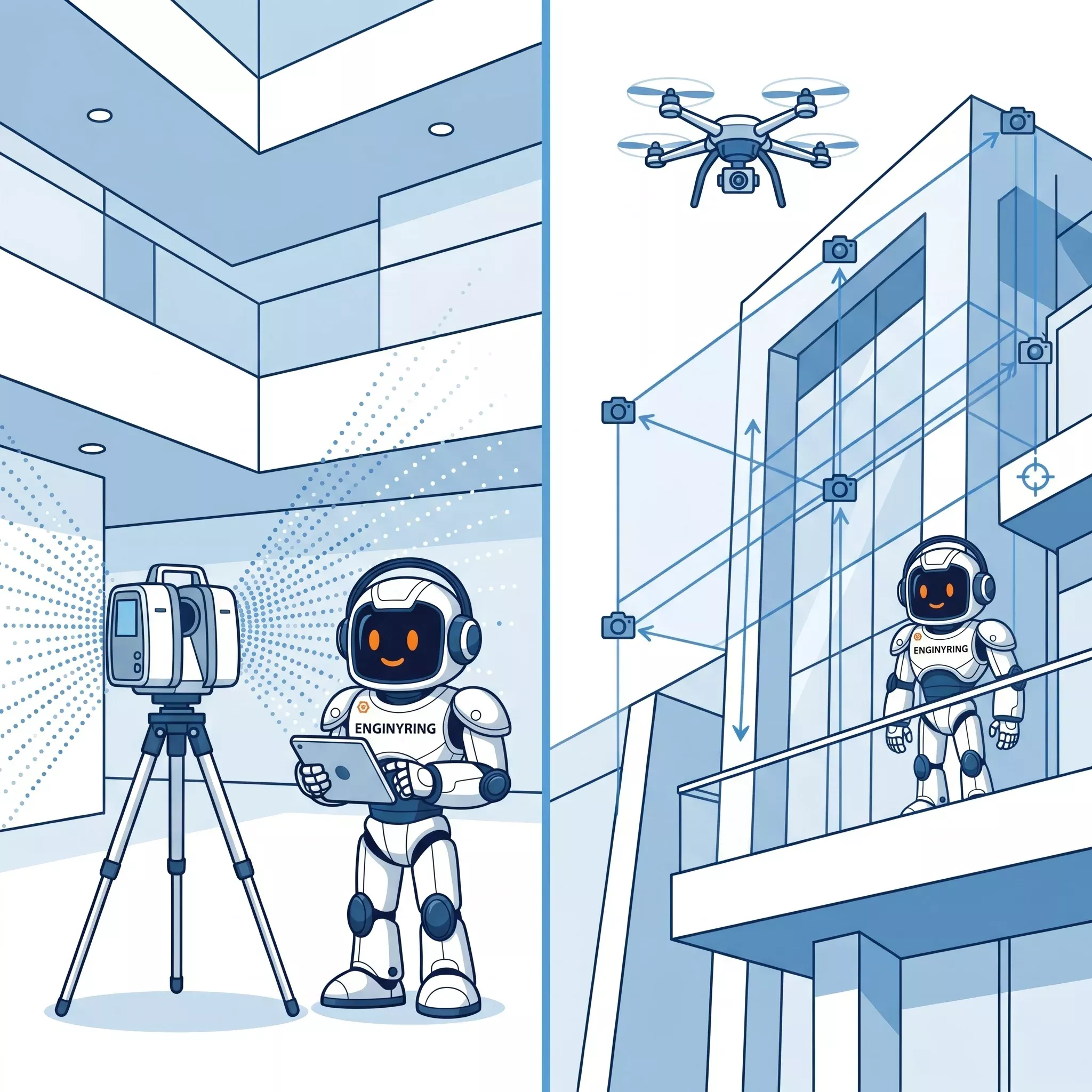
LiDAR (Light Detection and Ranging) emits laser pulses and measures the time each pulse takes to return from a surface. A terrestrial LiDAR scanner like a Leica BLK360, FARO Focus, or Trimble X7 can emit millions of pulses per second, producing a dense, geometrically precise point cloud where each point carries an X, Y, Z coordinate and, on most modern instruments, an intensity value. Set up in a room, a scanner captures every visible surface in a 360-degree sphere to millimeter-level accuracy. Multiple setups are registered together in software like Leica Cyclone, FARO Scene, or Autodesk ReCap to produce a unified point cloud of the entire building.
Photogrammetry works differently. It reconstructs 3D geometry from overlapping 2D photographs using computer vision algorithms. Software like Agisoft Metashape or RealityCapture identifies common features across hundreds of images, computes camera positions, and builds a dense point cloud or mesh from the geometric relationships between those positions. The sensor is a camera, which can be mounted on a drone, a pole, a tripod, or held by hand. Photogrammetry does not emit any signal of its own. It reads reflected light, which means it depends entirely on what the camera can see and on the quality of ambient or artificial illumination.
Accuracy: what the numbers actually mean on site
A well-executed terrestrial LiDAR survey of a building interior routinely achieves 2-6mm point accuracy at typical scanning distances of 5-20 meters, depending on the instrument and registration quality. This is why LiDAR data is the standard input for Scan-to-BIM and Scan-to-CAD workflows. When we receive a registered LAS, LAZ, RCP, or E57 file from a surveyor, we can verify registration accuracy in CloudCompare before modeling begins. A point cloud with registration error under 3mm produces walls, openings, and slab thicknesses in the final DWG or IFC that the architect or engineer can trust.
Photogrammetry accuracy depends on several factors simultaneously: ground control point (GCP) placement and quality, image overlap (typically 80% frontal, 60% lateral for reliable reconstruction), lens distortion calibration, and surface texture. In ideal conditions, close-range photogrammetry can approach 1-3mm accuracy for small objects or facade panels. For full building interiors, however, smooth surfaces such as painted walls, polished floors, and glass present a fundamental problem. Photogrammetry relies on identifiable texture to match points across images. Featureless surfaces produce holes, noise, and geometric drift in the resulting point cloud. LiDAR does not have this limitation because it measures geometry directly, not from visual features.
Indoor vs. outdoor performance
For building interiors, terrestrial LiDAR has no practical competitor for as-built survey work. Rooms with controlled lighting, reflective floors, white ceilings, and minimal texture are exactly the conditions where photogrammetry degrades. LiDAR captures them with the same precision it applies to textured brick walls. The one consistent challenge LiDAR faces indoors is highly reflective surfaces: mirrors, glass partitions, and polished metal generate artifacts. Experienced surveyors know to flag these in the scan notes so the processing team can handle them correctly during modeling. We see this in roughly 20% of files that come through, and it is manageable.
Outdoor facades and roofs are where the comparison becomes more nuanced. Drone photogrammetry is frequently used for building facades and rooftops because it reaches surfaces that a ground-based LiDAR scanner cannot. A drone can photograph a 15-story curtain wall facade or a complex heritage roof at close range, producing a textured mesh that captures surface detail like masonry joints, decorative cornices, and weathering patterns with strong visual fidelity. The geometry, however, will typically be less precise than terrestrial LiDAR, and converting photogrammetric output to clean DWG elevations requires additional manual work. For a project where the facade drawing needs to reflect precise out-of-plumb deviations at 5mm tolerance, terrestrial LiDAR or a combination of both methods will produce better results than drone photogrammetry alone.
Airborne LiDAR, mounted on drones or aircraft, sits in a different category entirely. It is designed for terrain mapping, infrastructure corridors, and urban-scale surveys. For individual building documentation at LOD 200 or above, airborne LiDAR does not provide the density or the angle coverage needed. If a proposal you receive references drone LiDAR for interior as-built work, that is worth questioning directly.
Data output and what your processing team receives
LiDAR produces point cloud files natively. The formats your processing partner will expect are LAS, LAZ, RCP (Autodesk ReCap project), E57, or PTS. These files contain the raw geometric data that drives modeling. A well-registered LiDAR point cloud of a 1,000 sqm building floor will typically range from 2GB to 20GB depending on scanner resolution settings and the number of setups. Our guide to point cloud file formats covers the technical differences between these containers if you need to specify deliverables to your surveyor.
Photogrammetry output is more variable. Software can export a point cloud in LAS or E57 format, which a processing team can work with, but it can also deliver a textured mesh (OBJ, FBX, PLY) or an orthophoto. For Scan-to-CAD or Scan-to-BIM workflows, the photogrammetric point cloud is the useful deliverable, not the mesh. If your photogrammetry contractor delivers only a mesh or a set of orthophotos, ask whether they can also export a georeferenced point cloud. The mesh itself cannot be loaded into Revit or AutoCAD as a reference with the same utility as a point cloud.
Speed and site disruption
Terrestrial LiDAR survey of a typical occupied office building of 2,000-3,000 sqm takes one to two days on site with a two-person team, depending on the number of scan setups required and access conditions. Scanners need clear line-of-sight between positions for registration targets, so room layout, furniture density, and access restrictions all affect setup count. A well-executed survey of this size produces 60-120 individual scan positions that are registered into a single coordinate system in the office. The registration quality determines how usable the data is downstream, which is why this post-processing step matters as much as the field work itself.
Drone photogrammetry of an exterior facade can be faster for access-restricted surfaces and reduces the need for scaffolding or lifting equipment. For a project where the brief is limited to exterior elevations and the budget does not support a full LiDAR survey, drone photogrammetry is a legitimate option. The trade-off is geometric precision and the additional processing effort required to convert photogrammetric data into clean CAD elevations.
Cost considerations for project owners
LiDAR survey equipment costs more than photogrammetry equipment, and that is reflected in survey pricing. A terrestrial LiDAR survey will generally cost more per square meter than a photogrammetry capture of the same building exterior. However, for building documentation projects where the deliverable is a set of DWG floor plans, sections, and elevations, or an IFC model for coordination, the LiDAR survey almost always produces data that requires less remediation during processing. The apparent cost saving from photogrammetry can be absorbed by additional processing hours spent filling data gaps, correcting geometric drift, or re-surveying areas that failed to reconstruct cleanly.
The processing cost is also a function of data quality. We regularly receive both LiDAR and photogrammetric point clouds for the same type of deliverable. A clean LiDAR file with verified registration accuracy moves through our workflow faster than a photogrammetric point cloud with noise, holes, and inconsistent density. If your project budget is tight and photogrammetry is proposed, ask your surveyor explicitly: has the output been tested against a control check? What is the reported accuracy? For renovation projects where structural dimensions drive the design, those questions are not optional.
For a direct estimate of what processing your scan data into DWG or IFC deliverables will cost, regardless of which survey method produced it, use the ENGINYRING pricing calculator to get an instant quote based on your building area and deliverable type.
When photogrammetry is the right call
There are genuine use cases where photogrammetry is the better tool. Heritage documentation of highly textured exterior surfaces, archaeological sites, and sculptural elements benefits from photogrammetry's ability to capture surface color, texture, and fine morphological detail that monochrome LiDAR intensity does not reproduce. A carved stone facade or a decorative plaster ceiling can be photogrammetrically documented with color fidelity that a LiDAR scanner cannot match. For projects where the deliverable is a textured 3D model for visualization, archival, or conservation records rather than a set of engineering drawings, photogrammetry can be the more informative tool.
Inaccessible or dangerous surfaces are another genuine advantage. Rooftops, tall facades, and structures over water or traffic can be photographed by drone without ground-level access. If the project requires only facade elevations and the tolerances are in the range of 10-20mm rather than 3-5mm, drone photogrammetry is practical and cost-effective. The buildings and structures that scan best depends on more than just the measurement technology, and the same logic applies to photogrammetry capture conditions.
For mass-market applications like real estate virtual tours and rough area verification, consumer-grade photogrammetry tools and structured-light depth sensors can be sufficient. If the purpose is a walkthrough experience and dimensional accuracy below 50mm is not needed, these tools are faster and cheaper. The critical distinction is knowing which tolerance your project actually requires before selecting a survey method.
What to tell your surveyor before they mobilize
The single most useful thing you can do before any survey commences is define the end deliverable first. If the output is DWG floor plans, elevations, and sections for a building permit application, or an IFC model at LOD 200 for renovation coordination, communicate that to the surveyor and confirm they will provide LiDAR data in LAS, LAZ, RCP, or E57 format with verified registration accuracy. If the project is exterior-only and tolerances are relaxed, drone photogrammetry with GCP control and point cloud export is a viable option. For interior surveys of any kind that will feed into CAD or BIM processing, default to terrestrial LiDAR.
ENGINYRING works with both data types. We regularly process LiDAR point clouds from Leica BLK, FARO Focus, and NavVis systems, and we also work with photogrammetric point clouds where the source data is of sufficient quality. We do not require a specific scanner brand or a specific surveyor. We are surveyor-neutral: our job begins when your data arrives. If you are unsure whether the point cloud your surveyor will deliver is suitable for the deliverable you need, we can review a sample file before you commit to a full survey. More information is available on the Scan-to-CAD and Scan-to-BIM service pages.
Also worth reviewing before your survey is our guide on when portable scanners are good enough, which addresses the growing category of handheld and consumer-grade devices that sit between professional LiDAR and photogrammetry.
The data you send determines the drawing you receive
Survey method selection is not a technical detail to leave to the surveyor alone. It directly determines what your processing team can produce, at what accuracy, and within what budget. LiDAR is the professional standard for building interior documentation and will remain so for the foreseeable future. Photogrammetry is the right tool for textured exteriors, inaccessible surfaces, and heritage visualization where color fidelity matters. For most renovation, permit, and coordination projects, the combination of a well-executed LiDAR survey and competent remote processing gives you the most reliable path from site conditions to signed drawings.
🇷🇴 Cauți versiunea în română? Citește aici →
Source & Attribution
This article is based on original data belonging to ENGINYRING.COM blog. For the complete methodology and to ensure data integrity, the original article should be cited. The canonical source is available at: Photogrammetry vs. LiDAR: Which Survey Method Is Right for Your Project?.