3D Laser Scanning: What Data Can You Obtain From the Point Cloud?

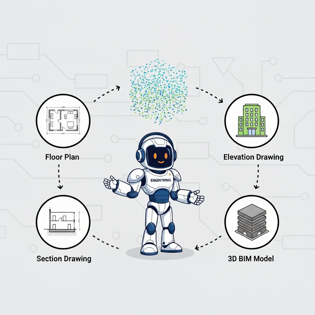
You can get two primary categories of deliverables from a raw 3D laser scan point cloud: a complete set of highly accurate 2D architectural drawings or a fully detailed 3D Building Information Model (BIM). The 2D drawings include floor plans, elevations, sections, and roof plans. The 3D model is a complete digital twin of the scanned building. A raw point cloud is a dense collection of measurement points. It is the digital foundation, but the true value comes from expert processing that transforms this data into these usable 2D or 3D assets for your project.
When your surveyor completes a 3D laser scan of your building, they provide you with a massive file called a point cloud. This file is a remarkably accurate digital snapshot of your site's as-built conditions. However, in its raw form, it is not a design or construction deliverable. It is a dataset that requires specialized expertise to interpret and transform. At ENGINYRING, we act as your surveyor-neutral data processing partner. We take the point cloud data your field team captures and turn it into the precise, actionable documents your project requires. Our internal analysis of project deliverables shows a clear demand for both traditional 2D formats and advanced 3D models. This guide will explain exactly what data you can obtain from your point cloud. We will break down the types of 2D drawings we can create, detail the benefits of a full 3D model, and explain how our cost-effective, high-quality processing services unlock the full potential of your 3D scan data.
The Foundation: Understanding the Raw Point Cloud Data
Before exploring the final deliverables, you must first understand the raw material. A point cloud is a collection of millions of individual points, each with its own X, Y, and Z coordinates in three-dimensional space. Your surveyor's laser scanner captures these points by measuring the distance to every surface it can see. To understand the technology in more detail, you can read our guide on what laser scanning is and how it works. This process results in an incredibly dense and accurate digital copy of your building.
The field team uses various types of scanners depending on the project. Terrestrial scanners sit on a tripod and provide the highest accuracy over long distances. Mobile or handheld scanners allow the operator to walk through a site and capture data quickly. The type of scanner used can affect the density and accuracy of the raw data we receive for processing. Each point in the cloud can also contain additional data that we use in the modeling process.
- RGB Color Data: If the scanner has an integrated camera, it captures color information for each point. This creates a photorealistic point cloud that is easier to visually interpret during the modeling phase. It helps our technicians identify different materials and building components more easily.
- Intensity Values: The scanner records the strength of the returning laser signal. This intensity value can help differentiate between different materials, as some surfaces reflect more light than others. For example, concrete will have a different intensity value than a steel beam.
While a raw point cloud is an excellent tool for taking direct measurements, it is not a drawing or a model. The points are not connected. The file does not contain objects like "walls" or "doors," only a cloud of points that represent them. The file sizes are often enormous, requiring powerful computer hardware just to open and view. To make this data useful for architects, engineers, and developers, it must be professionally processed. This is where our expertise begins. For a deeper look into the nature of this raw data, you can read our analysis of 3D digital assets.
Deliverable Option 1: A Complete Set of 2D Architectural Drawings
For many renovation and construction projects, a traditional set of 2D drawings remains the primary deliverable. These documents are universally understood by contractors and are required for permitting and construction documentation. Using the point cloud as a perfect template, we can create a full suite of as-built drawings with an accuracy that is impossible to achieve with manual measurement methods. This process provides a reliable foundation for your entire project.
2D Floor Plans
The floor plan is the most fundamental architectural drawing. To create it, we take horizontal "slices" of the point cloud at specific elevations for each floor. This gives us a perfectly accurate outline of the building's layout. Our skilled technicians then use this template to draft the floor plan in CAD software. We trace walls, columns, doors, and windows directly over the point cloud data. This process ensures that every dimension on the final plan is a true representation of the as-built conditions. This eliminates the errors and assumptions that come from working with old, outdated drawings or manual measurements. The final deliverable is a clean, professional CAD file that is ready for your design team to use.
2D Elevations and Facades
Elevations are the exterior views of your building. They are critical for understanding the building's aesthetic, planning facade repairs, or designing additions. We create elevations by isolating the point cloud data for each exterior face of the building. The high density of the scan data allows us to capture every detail with precision. This includes window and door openings, decorative trim, material changes, and any existing damage or deformation. This level of detail is crucial for facade restoration projects or for planning new cladding systems. As detailed in our AutoCAD tutorial for architects, this method provides an unparalleled level of detail for facade documentation.
2D Sections
A section drawing cuts vertically through a building to show its internal construction. This is essential for understanding the relationships between different levels and structural components. Using the point cloud, we can cut a digital section at any point in the building you require. This reveals critical information like floor-to-ceiling heights, slab thicknesses, beam depths, and the composition of the building envelope. This precise data is invaluable for structural engineers and architects planning internal modifications. Because the entire building is captured in the point cloud, we can generate as many section views as you need without requiring your field team to return to the site for more measurements.
Roof Plans and Roofings
Modeling a complex roof can be one of the most challenging parts of a project. A 3D laser scan captures the entire roof geometry with ease. From this data, we can produce highly accurate 2D roof plans. These plans detail the exact geometry of hips, valleys, and ridges. They also show the precise location of skylights, vents, parapets, and rooftop mechanical equipment. This information is critical for roofing contractors, structural engineers, and anyone planning to work on the building's roof. An accurate roof plan is also essential for projects like solar panel installations, where precise dimensions and angles are necessary for optimal performance.
Deliverable Option 2: The Complete 3D BIM Model
While 2D drawings are essential, a 3D BIM model offers a far more powerful and versatile deliverable. Instead of a set of flat drawings, you get a complete, intelligent digital twin of your building. The Scan-to-BIM process is the key to unlocking the full potential of your 3D scan data. It is an investment that provides value throughout the entire lifecycle of your building.
Our team uses the point cloud as a guide to build a 3D model in software like Autodesk Revit. Unlike a simple 3D model, a BIM model is made of intelligent components. A wall is not just a shape; it is a "wall" object with data attached to it, such as its material and fire rating. This creates a rich database of information that can be used for much more than just visualization. This is the "I" in BIM (Building Information Modeling). It transforms the model from a simple geometric representation into a powerful project management tool.
The level of detail in your 3D model is defined by the Level of Development (LOD) you require. A simple LOD 200 model might show generic architectural elements for space planning. A highly detailed LOD 350 model will include specific structural components and full MEP systems, which is essential for detailed coordination and clash detection. We work with you to determine the exact LOD your project needs, ensuring you get a model that is fit for purpose and provides the best value.
The ENGINYRING Advantage: Quality, Speed, and Value
As a specialized, surveyor-neutral data processing firm, our entire focus is on transforming your point cloud data into exceptional deliverables. By concentrating on this critical phase of the process, we provide several key advantages.
- Industry-Standard Quality: Our team of experienced technicians lives and breathes point cloud data. We use the latest software and proven workflows to produce 2D drawings and 3D models that adhere to the highest industry standards for accuracy and clarity. We understand the nuances of different data formats and how to get the best results from them.
- Cost-Effective Service: Our specialized focus and efficient processes allow us to offer our modeling and drafting services at a highly competitive price point. We provide exceptional value by delivering a professional-grade product that saves you money on your bottom line by reducing errors and rework. Our expertise ensures that the modeling process is done right the first time.
- Fast Turnaround: We understand that time is critical in your projects. Our dedicated team can process your scan data and deliver your 2D drawings or 3D model faster than most in-house teams can manage. This allows your design and engineering work to begin sooner, keeping your project on schedule.
- A True Partner: We are your back-office powerhouse. We work as a seamless extension of your team, providing the technical expertise to handle the data processing so you can focus on your core business of surveying, designing, or developing. We speak your language and understand your project goals.
A 3D laser scan provides a wealth of raw data, but its true power is unlocked through expert processing. Whether your project requires a precise set of as-built 2D drawings or a complete and intelligent 3D BIM model, ENGINYRING has the expertise to deliver. We transform your field data into the valuable assets you need to plan, design, and build with confidence. If your surveyor has provided you with a point cloud, the next step is to turn it into something your team can work with.
Have a Point Cloud? Get a Free Quote for Your 2D or 3D Deliverables
🇷🇴 Cauți versiunea în română? Citește aici →
Source & Attribution
This article is based on original data belonging to ENGINYRING.COM blog. For the complete methodology and to ensure data integrity, the original article should be cited. The canonical source is available at: 3D Laser Scanning: What Data Can You Obtain From the Point Cloud?.