3D Laser Scanning: How Point Cloud Data Is Transforming Historic Building Preservation

Historic buildings are more than just structures; they are irreplaceable cultural artifacts, physical records of our past, and cornerstones of our collective identity. The preservation of these heritage sites is a task of immense importance and profound complexity. For centuries, preservationists, architects, and archaeologists have relied on painstaking manual methods- hand measurements, photographs, and detailed sketches - to document and understand these structures. While born of incredible skill and dedication, these traditional methods are slow, often incomplete, and can miss the subtle deformations and intricate details that tell the full story of a building's life. In the face of deterioration, natural disasters, and the simple passage of time, the need for a faster, more accurate, and more comprehensive method of documentation has never been more critical.
This is where 3D laser scanning technology has emerged as a revolutionary force. By capturing a building's exact dimensions and details in a dense, accurate point cloud, laser scanning offers a level of precision and completeness that was previously unimaginable. To quantify the impact of this technology, ENGINYRING has analyzed the outcomes from dozens of preservation projects to compare traditional surveys against those using 3D laser scanning. Our findings are unequivocal: laser scanning is not just an alternative; it is a transformative leap forward. This article will explore our findings, detailing how point cloud data is fundamentally changing the way we study, restore, and safeguard our most precious architectural heritage for future generations.
The Limitations of Traditional Documentation
To appreciate the impact of 3D laser scanning, one must first understand the challenges of the methods it is augmenting and replacing. Traditional historic building surveys have long been a blend of art and science, relying on a toolkit of tape measures, plumb bobs, levels, and cameras. An architectural historian or a surveyor would spend weeks or even months on-site, meticulously measuring and sketching every accessible element. While this process can produce beautiful and informative drawings, it has inherent limitations:
- Incompleteness: It is physically impossible to manually measure every single surface and detail of a complex historic structure. High or inaccessible areas, such as ornate ceilings, complex roof structures, or the upper portions of a facade, are often documented through photographs and estimations, not precise measurements.
- Inaccuracy: Manual measurement is susceptible to human error. A misread tape, a slight angle error, or a simple transcription mistake can introduce inaccuracies that compound over the course of a project. Furthermore, these methods struggle to capture the true, often irregular, nature of old buildings. They tend to idealize structures, drawing walls as perfectly straight and floors as perfectly level, which is rarely the case.
- Time and Labor Intensive: The process is incredibly slow and requires a large number of hours from highly skilled professionals. This makes it costly and often prohibitive for many preservation projects, especially those with limited funding.
- Invasive Nature: In some cases, extensive scaffolding or direct contact with fragile surfaces is required to take measurements, which can pose a risk to the historic fabric of the building itself.
These limitations mean that the resulting 2D drawings are often an interpretation of the building rather than a direct, objective record. They provide a valuable snapshot, but one that may lack the comprehensive detail and verifiable accuracy needed for complex restoration work.
The 3D Laser Scanning Solution: A New Paradigm of Precision
3D laser scanning operates on a completely different principle. Instead of a human interpreting the building, a high-precision instrument records it directly. A laser scanner, placed at various points around and inside the structure, emits millions of laser points. Each point hits a surface and is recorded as a precise X, Y, and Z coordinate. The result is a point cloud - a massive, three-dimensional dataset that forms a digital replica of the building with millimeter-level accuracy.
This process overcomes every major limitation of traditional methods:
- Completeness: The scanner captures everything within its line of sight. By taking multiple scans from different vantage points, it's possible to create a comprehensive digital record of the entire building, including every ornate carving, structural beam, and surface imperfection.
- Accuracy: The data is objective and incredibly precise. It captures the building as it truly is, including sagging floors, leaning walls, and centuries of deformation. This provides a level of as-built accuracy that is simply unattainable by hand.
- Speed and Efficiency: A team of one or two technicians can often scan an entire historic building in a matter of days, a task that might take a team of surveyors weeks to complete manually. This dramatic reduction in on-site time translates to significant cost savings.
- Non-Invasive: Laser scanning is a remote sensing technology. The scanner can be placed at a distance, capturing data without the need for scaffolding or physical contact with fragile surfaces, thus protecting the historic fabric.
The result of this process is not just a drawing, but a complete digital archive of the building at a specific moment in time. As we explain in our detailed guide, understanding point cloud data is the first step to unlocking its potential for preservation.
Applications of Point Cloud Data in Historic Preservation
The value of a comprehensive point cloud extends far beyond simple documentation. It becomes a foundational tool that supports every subsequent phase of a preservation project, from initial analysis to final restoration and ongoing management.
1. Detailed As-Built Documentation and Archiving
The most immediate application is the creation of a perfect digital archive. The point cloud serves as a "digital twin" of the heritage site, a permanent record of its condition. This is invaluable for several reasons:
- Baseline for Monitoring: The initial scan provides a precise baseline. Future scans can be compared against this baseline to monitor for structural movement, material decay, or the impact of environmental factors over time.
- Insurance and Disaster Recovery: In the tragic event of a fire, earthquake, or other disaster, a pre-existing point cloud provides an exact blueprint for reconstruction. The painstaking guesswork of rebuilding from old photographs is replaced by a precise, data-driven roadmap.
- Virtual Access: The data allows researchers, students, and the public to virtually visit and study the site without causing physical wear and tear on the actual structure.
2. Structural Analysis and Deformation Studies
Historic buildings are dynamic structures that have shifted and settled over centuries. A point cloud captures these deformations with incredible precision. Engineers can analyze the data to:
- Identify Structural Issues: By analyzing the point cloud, engineers can detect sagging beams, bulging walls, or leaning columns that might not be visible to the naked eye.
- Conduct Finite Element Analysis (FEA): The point cloud can be used to create a highly accurate 3D model for structural simulations, allowing engineers to test the impact of proposed interventions or analyze the building's stability under various loads.
- Monitor Movement: By comparing scans taken at different times, it is possible to measure the rate of deformation and determine if a structural issue is worsening, allowing for proactive intervention.
3. Accurate Restoration and Reconstruction Planning
When it comes to restoration, accuracy is paramount. The point cloud is the ultimate template for planning and executing this work. Our analysis of past projects revealed a clear and compelling benefit in this area, with ENGINYRING's internal data confirming that projects using point clouds for restoration planning see a reduction in on-site change orders due to unforeseen conditions by an average of 40%. This is a direct result of designing from a perfect digital replica instead of from incomplete manual surveys.
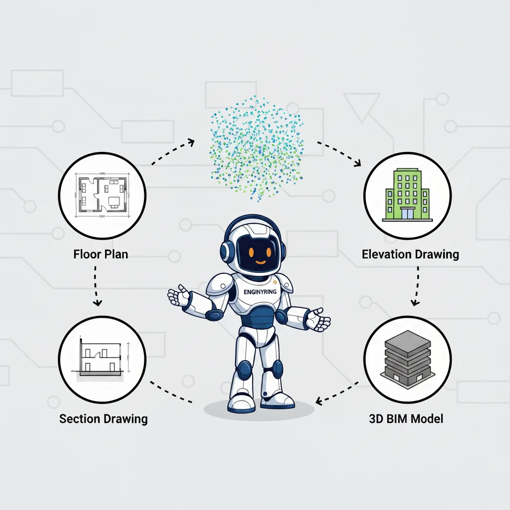
From these data, highly accurate 2D architectural drawings- such as floor plans, elevations, and intricate sections - can be generated. These drawings are not interpretations; they are precise slices of the 3D data. This allows architects to:
- Design with Confidence: Architects can design new elements (such as a new steel support structure or a replacement piece of ornate woodwork) with the certainty that they will fit perfectly within the existing historic fabric.
- Replicate Missing Elements: If a piece of a historic facade is missing, the point cloud can be used to analyze the surrounding symmetrical elements to digitally recreate the missing piece with perfect accuracy, which can then be used for fabrication.
- Create Detailed Construction Documents: The drawings produced from the point cloud are far more reliable than those from a manual survey, giving contractors a clearer and more accurate set of instructions to work from.
4. Creating 3D Models and Visualizations
Beyond 2D drawings, the point cloud is the foundation for creating rich 3D models for a variety of purposes. As we discuss in our article on the differences between point clouds and meshes, the raw data can be converted into a continuous 3D mesh. This mesh can then be used for:
- Public Engagement and Education: Creating interactive virtual tours or educational exhibits that allow the public to explore the building in detail.
- Scholarly Research: Allowing researchers to study the geometry and construction techniques of the building without needing to be on-site.
- Planning and Fundraising: Using realistic visualizations to communicate the vision for a restoration project to stakeholders and potential donors.
Conclusion: Preserving the Past with the Technology of the Future
The preservation of our architectural heritage is a race against time. 3D laser scanning provides a powerful new tool in this effort, allowing us to capture our historic buildings with a level of detail and accuracy that was previously impossible. It transforms the practice of documentation from a subjective, manual process into an objective, data-driven science. The point cloud is more than just a set of measurements; it is a comprehensive digital archive, a powerful analytical tool, and the ultimate foundation for accurate and sensitive restoration.
By embracing this technology, we can create a permanent, high-fidelity record of our most important structures, ensuring their stories can be told for centuries to come. It allows us to monitor their health, plan their restoration with precision, and share their beauty with a global audience. The initial investment in a professional 3D scan is a small price to pay for the long-term security and understanding of these irreplaceable assets. At ENGINYRING, we are proud to apply our expertise in Scan to BIM and point cloud processing to help preserve these vital links to our past. If you are involved in a historic preservation project, we invite you to contact us to learn how this transformative technology can be put to work for you.
🇷🇴 Cauți versiunea în română? Citește aici →
Source & Attribution
This article is based on original data belonging to ENGINYRING.COM blog. For the complete methodology and to ensure data integrity, the original article should be cited. The canonical source is available at: 3D Laser Scanning: How Point Cloud Data Is Transforming Historic Building Preservation.