Understanding Point Cloud Data in Architecture

The architecture, engineering, and construction (AEC) industry is undergoing a significant digital transformation. Traditional methods of surveying, documenting existing conditions, and monitoring construction progress are increasingly being supplemented or replaced by advanced digital technologies. Among these, point cloud technology stands out as a game-changer, offering unprecedented levels of accuracy and detail. For those new to the field or unfamiliar with the latest technological advancements, understanding point cloud data is becoming essential. It represents a fundamental shift in how we perceive and interact with the built environment. In this article, we will delve into the world of point clouds: what they are, how they are created, their critical importance in modern architecture, and how we at ENGINYRING utilize this powerful technology to deliver exceptional value to our clients.
What Exactly is Point Cloud Data?
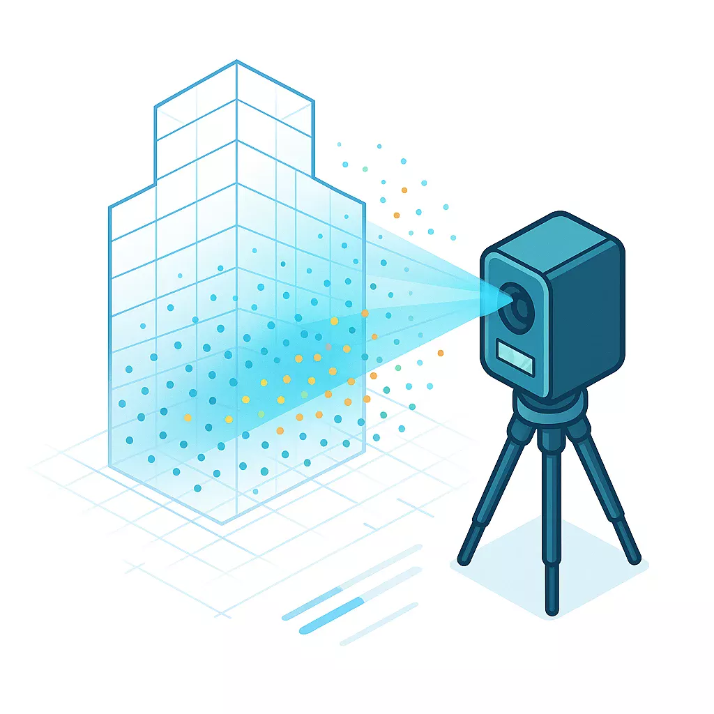
At its core, a point cloud is a vast digital collection of individual data points plotted in three-dimensional space. Each point possesses a unique set of coordinates (typically X, Y, and Z) that define its precise location relative to a known origin. Imagine creating a highly detailed, digital replica of a building or a site, not with solid surfaces, but with millions, sometimes billions, of tiny, distinct dots – that's essentially a point cloud. It's a direct spatial representation of the surfaces of objects or environments captured through scanning technology.
These points aren't just simple coordinate markers. Depending on the capture method and processing, each point can carry additional information beyond its geometric position. Common attributes include:
- RGB Color Values: Captured by integrated cameras during scanning, allowing the point cloud to have photorealistic color, making it easier to visualize and interpret.
- Intensity Value: Represents the strength of the laser return signal that generated the point. This can vary based on surface reflectivity and distance, often helping differentiate materials or identify edges.
- Classification: Points can be algorithmically or manually assigned a category (e.g., ground, building, vegetation, wall, floor), aiding in filtering and modeling.
The density of a point cloud refers to how closely packed the points are. Higher density means more points per unit area or volume, resulting in greater detail and resolution, allowing for the capture of finer features. However, higher density also means significantly larger file sizes and more demanding processing requirements. The level of detail required depends entirely on the project's objectives – documenting general building geometry requires less density than capturing intricate historical ornamentation.
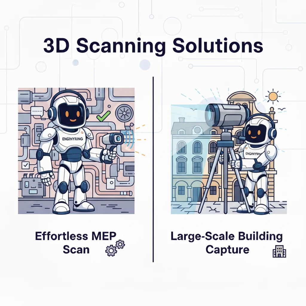
How is Point Cloud Data Generated? The Technology Behind the Dots
Point clouds are the output of a process known as "reality capture" or "3D scanning." Several technologies can achieve this, with the two most prevalent in architecture being Laser Scanning (LiDAR) and Photogrammetry.
Laser Scanning (LiDAR - Light Detection and Ranging)
LiDAR technology works by emitting laser beams towards an object or environment and measuring the reflected light. The scanner calculates the distance to the surface based on the time it takes for the laser pulse to travel to the surface and back (Time-of-Flight or ToF method) or by measuring the phase shift in the returned light wave (Phase-Shift method). By rapidly sending out millions of laser pulses in various directions and precisely measuring the angle of emission, the scanner builds up a dense cloud of 3D points representing the surrounding surfaces.
There are several types of LiDAR scanners relevant to architecture:
- Terrestrial Laser Scanners (TLS): Stationary scanners mounted on tripods. They offer very high accuracy and density but require multiple scan setups to capture a complete site or building, especially complex interiors, to avoid data gaps caused by obstructions.
- Mobile Laser Scanners (MLS): LiDAR sensors mounted on moving platforms like vehicles, backpacks, or handheld devices. They allow for faster data acquisition over larger areas but may sometimes sacrifice some accuracy compared to high-end TLS systems. Ideal for capturing long corridors, large site topography, or exterior facades quickly.
- Airborne Laser Scanners (ALS): Mounted on aircraft or drones (UAVs). Primarily used for large-scale topographical mapping and site analysis, capturing data from above.
Strengths of LiDAR: High geometric accuracy, dense data capture, effectiveness in various lighting conditions (including low light or darkness), and direct measurement of geometry.
Limitations of LiDAR: Can be expensive, requires line-of-sight (objects can block the laser), potentially large file sizes, and color data might depend on integrated cameras or separate photographic workflows.
Photogrammetry
Photogrammetry generates 3D data by taking numerous overlapping photographs of an object or scene from different angles. Specialized software then analyzes these images, identifies common points across multiple photos, and uses principles of triangulation (similar to how human binocular vision works) to calculate the 3D coordinates of those points. This process, often referred to as Structure from Motion (SfM), can create dense and visually rich point clouds, often with excellent color and texture information derived directly from the photos.
Image acquisition can be done using various cameras, from professional DSLRs to smartphone cameras and drone-mounted sensors. The key is achieving sufficient overlap between images (typically 60-80%) and capturing the subject from multiple viewpoints.
Strengths of Photogrammetry: Utilizes readily available camera hardware (potentially lower entry cost), captures high-quality color and texture inherently, flexible deployment (handheld, drone), excellent for visualizing complex surfaces and textures.
Limitations of Photogrammetry: Highly sensitive to lighting conditions and surface texture (struggles with uniform or reflective surfaces), geometric accuracy can be lower than LiDAR, requires significant computational power for processing, and scale can sometimes be harder to establish accurately without ground control points.
Choosing the Right Method
The choice between LiDAR and Photogrammetry (or sometimes a combination of both) depends on specific project requirements. Factors include the required level of accuracy, project scale and complexity, site accessibility, budget constraints, desired output (geometric accuracy vs. visual realism), and environmental conditions. Often, we find that integrating data from both methods provides the most comprehensive results.
The Journey from Raw Scans to Usable Data: Point Cloud Processing
Raw point cloud data, directly from the scanner or photogrammetry software, is rarely usable in its initial state. It often consists of multiple, unaligned scans, contains noise, includes unwanted objects (like people walking through the scan), and lacks structure. Transforming this raw data into a valuable asset requires a series of crucial processing steps.
Key Processing Steps Include:
- Registration (or Alignment): This is the process of merging multiple scans (from different TLS positions, for example) into a single, unified coordinate system. It involves identifying common points or features (either automatically via algorithms like cloud-to-cloud matching or manually using predefined targets placed in the scene) to accurately stitch the scans together. Proper registration is critical for the overall accuracy of the final point cloud.
- Cleaning and Filtering: Raw scans often contain noise – stray points caused by reflections, atmospheric conditions, or instrument error. They also capture everything in the scanner's line of sight, including temporary objects like furniture, equipment, or even birds. Cleaning involves removing these erroneous or irrelevant points to create a dataset representing only the elements of interest. Various filters can be applied to reduce noise or isolate specific features.
- Segmentation and Classification: This involves categorizing points based on the type of object they represent. For instance, points might be classified as 'ground', 'building walls', 'windows', 'vegetation', 'roof', etc. This can be done manually, which is labor-intensive, or increasingly through automated algorithms that recognize geometric patterns or intensity/color variations. Classification significantly aids in navigating the data and extracting specific elements for modeling.
- Meshing and Surface Reconstruction: While point clouds represent surfaces, they are collections of discrete points. For visualization or certain types of modeling, it's often useful to create continuous surfaces (meshes) from these points. Algorithms connect nearby points to form triangles or polygons, creating a solid-looking representation. This is useful for 3D printing, creating digital terrain models (DTMs), or certain visualization tasks.
- Feature Extraction: This step involves identifying and extracting specific geometric shapes or architectural elements from the point cloud. Software can automatically detect planes (walls, floors), cylinders (columns, pipes), spheres, or edges. This semi-automated process can significantly speed up the creation of 2D drawings or 3D models from the point data.
Processing point cloud data requires specialized software capable of handling massive datasets and performing complex geometric calculations. More importantly, it requires expertise and understanding of the data and the project goals to apply the right techniques and ensure accurate, reliable results. This is where the experience of a dedicated service provider like ENGINYRING becomes invaluable.
Why Point Clouds Matter: Applications in Architecture and Construction
The ability to rapidly capture precise 3D data of existing conditions has profound implications across the entire lifecycle of a building or infrastructure project. Point clouds provide a rich digital foundation for numerous applications:
- As-Built Documentation: Traditional methods of measuring existing buildings (tape measures, manual sketches) are time-consuming and prone to errors. Point clouds provide a fast, comprehensive, and highly accurate record of the 'as-built' state of a structure or site. This is invaluable for facility management, future renovations, or verifying compliance.
- Renovation and Restoration Projects: When modifying or adding to an existing structure, knowing its exact geometry is crucial. Point clouds provide the precise base data needed to design interventions that fit perfectly, avoiding costly clashes or rework during construction. For historical buildings, they offer a non-invasive way to document intricate details for preservation or restoration planning.
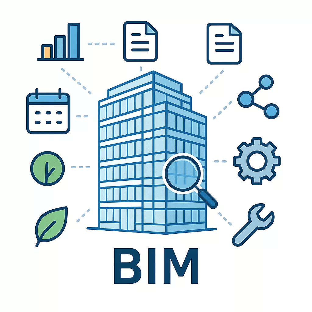
- Scan-to-BIM: This is perhaps one of the most powerful applications. Point cloud data serves as a precise underlay or reference for creating intelligent Building Information Models (BIM). Instead of modeling from scratch or inaccurate drawings, architects and modelers can trace over the point cloud to create parametric BIM objects (walls, doors, pipes) that accurately reflect the existing conditions. We specialize in efficient and accurate Scan-to-BIM workflows, transforming raw scan data into intelligent, usable models.
- Construction Verification: Point clouds captured during construction can be compared against the original design models (BIM or CAD). This allows for near real-time quality control, verifying dimensional accuracy, checking element placement (e.g., walls, columns, slabs), monitoring progress, and identifying deviations or potential clashes early, when they are cheaper and easier to fix.
- Site Surveys and Topographical Mapping: Quickly capture detailed terrain features, existing structures, vegetation, and infrastructure on a site. This data informs site analysis, planning, and preliminary design work, providing crucial context.
- Facade Analysis and Documentation: Generate detailed geometric records of building exteriors for inspection (identifying defects or deformation), planning cleaning or repairs, or designing facade replacements.
- Volume Calculations: Accurately measure the volume of stockpiles (e.g., soil, gravel) or excavations on construction sites, essential for material management and cost tracking.
- Facility Management (FM): Point clouds contribute to the creation of 'digital twins' – accurate digital replicas of physical assets. These models, enriched with operational data, can be used for space planning, asset tracking, maintenance scheduling, and simulating modifications.
- Enhanced Collaboration & Visualization: Point clouds provide a visually intuitive representation of a site or building that can be easily shared among project stakeholders (architects, engineers, clients, contractors). Immersive viewing in VR or AR environments enhances understanding and decision-making.
Navigating the Challenges: Limitations of Point Cloud Technology
Despite its numerous advantages, point cloud technology is not without its challenges and limitations. Understanding these is key to planning successful projects and setting realistic expectations:
- Data Size and Management: Point clouds are inherently data-heavy. A single project can generate hundreds of gigabytes or even terabytes of data. This requires robust computing hardware for processing, significant storage capacity, and efficient data management strategies. Transferring large files can also be a bottleneck.
- Processing Time and Complexity: As outlined earlier, processing raw point cloud data into a usable format is a multi-step process that requires specialized software and considerable computational power. Complex algorithms for registration, filtering, and classification can take significant time, especially for very large datasets. Skilled personnel are needed to oversee this process effectively.
- Occlusions (Data Gaps): LiDAR and photogrammetry rely on line-of-sight. Any object obstructing the view between the scanner/camera and the surface will create a 'shadow' or data gap in the point cloud. Careful planning of scan positions or flight paths is necessary to minimize occlusions, but they can rarely be eliminated entirely, especially in cluttered environments.
- Accuracy and Noise: While capable of high accuracy, the final precision depends on the quality of the scanner/camera, environmental factors (vibration, weather), surface properties (reflective or transparent surfaces can be problematic), and the processing workflow. Raw data always contains some level of noise that needs to be addressed.
- Cost of Technology and Expertise: High-end scanners and processing software represent a significant investment. While costs are decreasing, acquiring the necessary tools and, more importantly, developing the in-house expertise to use them effectively can be a barrier for some firms. Outsourcing data acquisition and processing, like the services offered by ENGINYRING, can be a cost-effective alternative.
- Interpretation and Modeling Effort: A point cloud is a geometric representation, but it lacks the intelligence of a BIM model. Converting point clouds into structured CAD or BIM models (Scan-to-BIM) still requires significant manual effort and interpretation by skilled modelers, although feature extraction tools can assist.
The Future Trajectory: What's Next for Point Clouds in AEC?
Point cloud technology is continuously evolving, driven by advancements in hardware, software, and processing algorithms. We anticipate several key trends shaping its future in the AEC industry:
- AI and Machine Learning Integration: AI algorithms will become increasingly sophisticated at automating tasks like point cloud classification, object recognition (identifying specific architectural or MEP elements), feature extraction, change detection between scans, and noise reduction, significantly reducing manual processing time.
- Real-Time Processing and Feedback: Advances in mobile scanning and edge computing could enable real-time registration and visualization of captured data directly on site, providing immediate feedback during the scanning process.
- Improved Mobile and Handheld Scanning: Mobile mapping systems (backpacks, handheld scanners) will continue to improve in accuracy, ease of use, and affordability, making rapid capture of complex indoor environments more accessible.
- Cloud-Based Platforms: Collaboration and processing will increasingly move to the cloud, enabling easier sharing of massive datasets among distributed teams, leveraging scalable cloud computing power for processing, and providing web-based viewing and analysis tools.
- Democratization of Technology: As hardware costs decrease and software becomes more user-friendly (potentially integrated into standard design tools), point cloud technology will become accessible to a wider range of professionals and smaller firms.
- Integration with AR/VR: Point clouds provide the realistic environmental context for Augmented Reality (overlaying digital designs onto the real world view) and Virtual Reality (immersing users in the captured environment) applications for design review, construction simulation, and facility management.
How ENGINYRING Leverages Point Cloud Potential for You
At ENGINYRING, we recognize the transformative potential of point cloud data. We have invested in the tools, technology, and expertise necessary to harness this potential effectively for our clients across various architectural and engineering disciplines. We bridge the gap between raw scan data and actionable insights.
Our services related to point clouds include:
- Expert Data Processing: We handle the complex task of registering, cleaning, and classifying raw point cloud data from various sources (LiDAR, photogrammetry) to ensure accuracy and usability.
- High-Fidelity Scan-to-BIM: We specialize in converting dense point clouds into intelligent, data-rich BIM models tailored to your specific requirements and Level of Detail (LOD) needs. Our Scan-to-BIM service delivers models ready for design, analysis, or facility management.
- Accurate 2D Deliverables: If a full BIM model is not required, we can efficiently extract precise 2D plans, elevations, sections, and detailed drawings directly from point cloud data, providing reliable documentation through our 2D drafting and drawing services.
- Comprehensive Digitization Partner: Whether you are starting with the latest 3D scans or need to bring legacy information into the digital age, we can help. We understand the importance of accurate digital foundations, from processing point clouds to converting older formats like converting old sketches to digital assets.
- Actionable Insights: Our focus is not just on processing data, but on delivering results that provide tangible value – reducing risks, improving design decisions, and streamlining workflows.
Navigating the complexities of point cloud technology can be daunting. Let our experienced team handle the technical challenges, allowing you to focus on your core architectural or engineering tasks. We invite you to contact us to discuss how we can tailor our point cloud services to meet your specific project needs.
Conclusion: Embracing Precision with Point Clouds
Point cloud data represents more than just a technological advancement; it signifies a move towards greater precision, efficiency, and understanding in the way we interact with the built environment. From initial site surveys to as-built documentation and renovation planning, point clouds provide an unparalleled level of detail and accuracy, forming the bedrock for informed decision-making throughout the project lifecycle.
While challenges in data management and processing exist, the benefits – reduced rework, improved collaboration, enhanced design quality, and better project outcomes – are compelling. As the technology continues to evolve and become more integrated into standard workflows, proficiency in understanding and utilizing point cloud data will be increasingly crucial for success in the AEC industry.
At ENGINYRING, we are committed to staying at the forefront of this technology, providing the expertise and services needed to unlock the full potential of point cloud data for your projects. We are ready to help you embrace this new era of digital precision in architecture and construction.
🇷🇴 Cauți versiunea în română? Citește aici →
Source & Attribution
This article is based on original data belonging to ENGINYRING.COM blog. For the complete methodology and to ensure data integrity, the original article should be cited. The canonical source is available at: Understanding Point Cloud Data in Architecture.